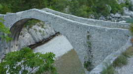
Pont de Carajuan/Trigance :
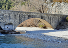 The Carajuan bridge spans the Verdon, connecting the common right bank of Rougon to the common left bank of Trigance. This is a moderately trafficked 8.4 kilometer round trip trail. The trail partly runs along the Verdon and the "Jabron" river, its difficulty is assessed as moderate with a positive elevation of 295 m.
Ideal family hike. Approx 3h round trip
Camping de Carajuan/Rougon :
 The start of this hike is just in front of the campsite, crossing the road the "montée" called "fluis" is offered to you.
In a stony but shaded path, you will make a beautiful hike, up to the ravine of Fondis to arrive at the barre des Aigles, on a steep slope, place of flight of the griffon vultures, we admire the course of the Verdon just before its entry into the Samson corridor, Grand Canyon du Verdon and, further west, view of the village of Rougon and its castle, which you can reach and visit before descending by the same path. 450 meters of elevation gain.
Approx 4h30 round trip.
 A Camping / return Camping loop :
Itinerary: At the carajuan bridge, take the track that descends to the south towards Trigance. Then follow the D90 north towards the bridge over the Jabron. At the bridge, turn left towards Trigance – then take the “Tête de Breis” track which allows you to bypass the summit of Breis from the north. To the west of the summit of Breis take the path westwards at hill 1033 to join the GR49 at hill 1076. Leave the GR to the belvedere of Rancoumas which overlooks the canyon. From Belvédère follow the chemin des Crêtes to join the GR at hill 899. Go down to the Tusset bridge following the GR. At the bridge go up to Point Sublime. Go up to Rougon by taking a dirt road to the right on the D17 at hill 787. In Rougon go up to the ruins of the Castle to see the viewpoint. Leave Rougon to the east, following the track in front of the oratory and halfway up the “Gestures” slope. From there descend to the plateau above the Eagle bar towards the Carajuan bridge.
Map IGN : TOP 25 N° 3442 OT
Distance : 23,5 km - maximum altitude : 1095 m - minimum altitude : 609 m
Duration: The loop takes about 6 hours

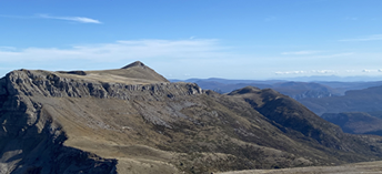
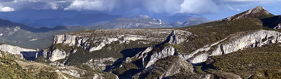
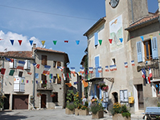
The hikes from the village of Rougon :
 Hikking : "Le sentier Blanc-Martel"
This trail is named after the French speleologist Édouard-Alfred Martel (1859-1938) and the teacher from ROUGON Isidore Blanc who was the guide of the speleologist during the 1905 expedition.
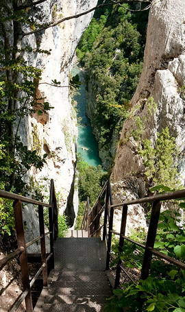
The Blanc-Martel trail is the most famous hiking trail in the Gorges du Verdon. It goes along the river or overhangs it and the panoramas are sublime. The departure is located at the chalet de la Maline, then you will successively cross the scree of Guègues, the stairs of the Imbert breach, the baume aux Pigeons, the two tunnels, to arrive at the Point Sublime.
Some practical advice :
Some passages can be delicate and vertiginous (stairs, screes...)
You will need hiking shoes, 2 liters of water per person, 1 lamp, protection against the sun (hat, cream...) and against the cold.
The trail is forbidden to mountain bikes and dogs.
Hike of 15km - 600m of difference in altitude - 5 to 7 hours of walking.
Organization of the shuttle :
Zou's schedule and the schedule of the shuttle
Other sports
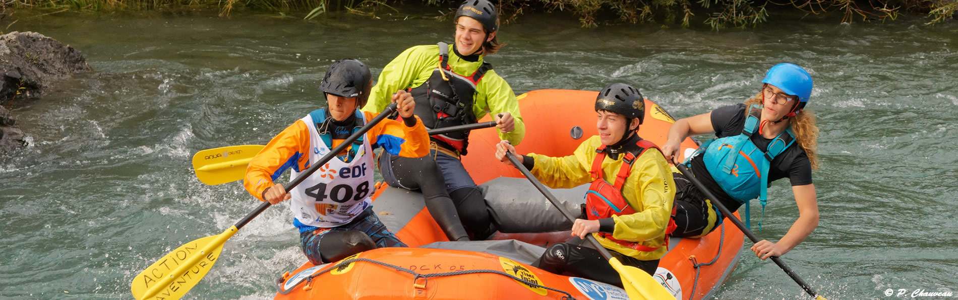
 water sports :
- Opt for white water sports: canyoning, aquatic hiking, rafting, kayaking... courses for all levels. Reservation essential as they are very popular
- You can also practice fresh water sports: pedal boats, electric boats, canoes, paddles on the lakes of Sainte Croix, Esparron du Verdon, Castillon or Quinson.
- You can relax on very beautiful beaches and swim. The waters are warm and of a very intense blue color.
Climbing :
In the heart of the Verdon regional natural park, the large limestone cliffs of exceptional quality offer you more than 1500 routes in countless sectors, multi-pitch routes and school cliffs for all levels.
The bike :
- Cycling circuits and itineraries to discover the emblematic landscapes of Provence between lakes and gorges at your own pace.
- TransVerdon: The 11th longest mountain bike crossing in France labeled by the FFC: 300 km Col d'Allos in Gréoux-les-Bains
- Rental of electric bicycles.
Adapted to all levels, both technical and family courses offer a diversity of practices.
Paragliding :
Take a paraglider flight and fly over the most beautiful landscapes of the territory.